Georadar Drone: Exploring the Depths with Advanced Technology

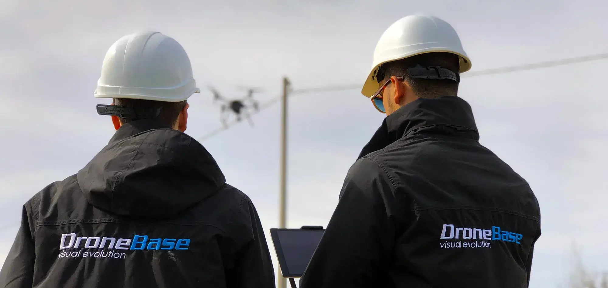
The world of drone technology is reaching new heights with the introduction of the georadar drone, a device that combines the capabilities of drones with the power of georadar to explore the depths of the ground in an advanced way. In this article, we will explore the revolutionary applications of the georadar drone, highlighting how this technology is changing the landscape of geological exploration and ground investigation.

Technology in the Service of Geological Exploration.

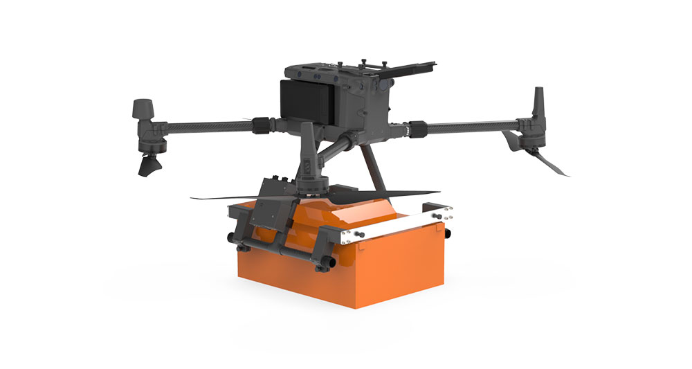
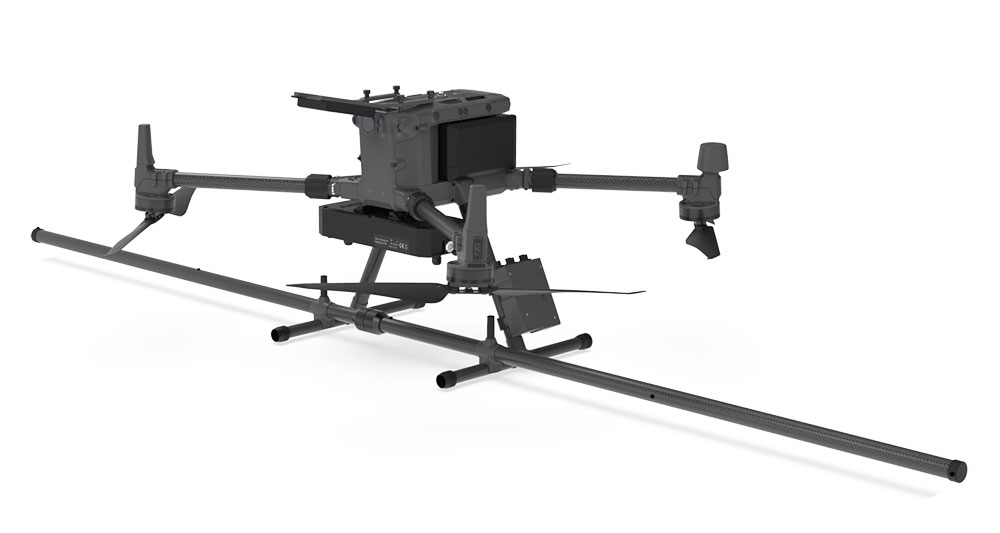
The georadar drone represents a leap forward in geological exploration operations. Its ability to integrate georadar with the maneuverability and accessibility of drones provides an effective solution for detailed subsurface investigations. This innovative approach is revolutionizing geological data collection, offering unprecedented insight into terrain characteristics.

Practical Applications of Drone Georadar

Environmental Surveys: The georadar drone is an effective tool for detecting soil composition and identifying potential contamination. This application is critical for environmental management and risk assessment in pollution-prone areas.

Mining Exploration: In the mining industry, the georadar drone provides a detailed assessment of underground resources. It can identify the presence of mineral deposits and characterize the geological structure of areas of interest.

Civil and Geotechnical Engineering: In civil engineering, the georadar drone is used to assess ground stability, identify potential foundation problems, and map subsurface structure prior to construction projects.

Hydrogeological Research: Locating groundwater resources is essential for many regions. The georadar drone can help identify aquifers and monitor hydrogeological dynamics.

Key Advantages of Georadar Technology in Drones

Depth of Penetration: Georadar allows the drone to penetrate the ground to significant depths, providing detailed information about the deepest levels of soil.

Speed and Efficiency: Compared with traditional methods, the georadar drone allows large areas to be covered in a shorter time, improving the efficiency of exploration operations.

Cost Reduction: The use of georadar drones reduces the costs associated with geological surveys by eliminating the need for complex ground assets and long preparation times.

Remote Accessibility: Drones can reach areas that are difficult for human operators to access or dangerous, providing wide geographic coverage.

Expanding the Frontiers of Geological Knowledge.

In conclusion, the georadar drone represents a significant breakthrough in geological surveys, taking technology and efficiency of exploration operations to new levels. Its practical applications in environmental surveys, civil engineering, mining, and hydrogeological research demonstrate its transformative potential. With the ability to explore the depths of the earth quickly and efficiently, this technology is expanding the frontiers of geological knowledge and contributing substantially to multiple fields.

Drone Georadar, Drone Georadar

Efficient

Acquire data faster than traditional methods

Drone Georadar, Drone Georadar

Precise

The drone's precise positioning and rangefinder systems ensure high-precision measurements

Drone Georadar, Drone Georadar

Cheap

UAV surveys are more cost-effective than traditional methods

Drone Georadar, Drone Georadar

Sure

The integrated system can be used in hazardous and unsafe environments without compromising the safety of personnel

Drone Georadar, Drone Georadar

Precise

GNSS RTK positioning systems and Radar rangefinder ensure accurate measurements at very low altitude

Drone Georadar, Drone Georadar

Smart

Total integration between sensor, drone and software ensure precise and intuitive operation

Discover all the benefits of Georadar technology for Drones

Drone Georadar, Drone Georadar

WHO WE ARE.

DroneBase SRL is now one of the most relevant companies in the national and international drone scene, thanks to our ability to conceive, design, manufacture and certify drones of high industrial level. Our facilities cover an area of nearly 700 square meters, including advanced research and development laboratories, test benches, production lines, flight simulators, areas dedicated to engineering and design, a showroom, a training room (equipped with a 10,000-square-meter airfield), warehouses and offices. Our team consists of highly qualified personnel, including mechanical, electronic and aeronautical engineers, as well as designers and beta testers.

Currently, Dronebase produces five different models of
professional drones (APRs)
, along with the innovative
DBase (Drone in a Box)
, a fully autonomous solution for remote drone management. We also offer several models of
gimbals and payloads
customized.

Thanks to a handcrafted production process that meets strict quality standards certified by
ISO 9001-2015
, DroneBase SRL develops a line of multi-role solutions that are distinguished by their high performance, safety and the ability to be customized to our customers’ specific application needs.

Discover our Solutions with Georadar

Drone Georadar, Drone Georadar

Drone Georadar

Drone bundle with Georadar ready to use

Drone Georadar, Drone Georadar

Drone Magnetometer

Drone bundle with Georadar ready to use

Talk to one of our Experts

DroneBase provides you with an Expert Advisor
Able to recommend the most appropriate product for your needs
And answer all your questions.

Call us NOW!
+39.0541.1790411
Request information

Please enter your details below, our consultant will
will contact back as soon as possible and provide you with all the details!


    Talk to an Expert

    Thank you for your interest in our solutions

    Fill out the Form opposite and you will be contacted
    by one of our Expert Advisors who will provide you with
    The Best Solution for Your Need!

    Thank you for your confidence.

    Team DroneBase

      Download Now

      Thank you for your interest in our applications.

      Fill out the Form next to it to receive:

      • Dataset
      • Abstracts
      • Report
      • Full Datasheet

      Request a consultation with one of our Experts to Point you to the Best Solution for Your
      Necessity!

      Thank you for your confidence.

      Team DroneBase

        Download Now

        Thank you for your interest in our applications.

        Fill out the Form next to it to receive:

        • Dataset
        • Abstracts
        • Report
        • Full Datasheet

        Request a consultation with one of our Experts to Point you to the Best Solution for Your
        Necessity!

        Thank you for your confidence.

        Team DroneBase

          Talk to an Expert

          Thank you for your interest in our applications

          Fill out the Form opposite and you will be contacted by one of our Expert Consultants who will provide you with the Best Solution for YOUR NEEDS!

          Thank you for your confidence.

          Team DroneBase

            Talk to an Expert

            Thank you for your interest in our Video Surveillance solutions

            Fill out the Form opposite and you will be contacted
            by one of our Expert Advisors who will provide you with
            The Best Solution for Your Need!

            Thank you for your confidence.

            Team DroneBase

              Download Now

              Thank you for your interest in our applications.

              Fill out the Form next to it to receive:

              • Dataset
              • Abstracts
              • Report
              • Full Datasheet

              Request a consultation with one of our Experts to Point you to the Best Solution for Your Need!

              Thank you for your confidence.

              Team DroneBase

                Download Now

                Thank you for your interest in our applications.

                Fill out the Form next to it to receive:

                • Dataset
                • Abstracts
                • Report
                • Full Datasheet

                Request a consultation with one of our Experts to Point you to the Best Solution for Your
                Necessity!

                Thank you for your confidence.

                Team DroneBase