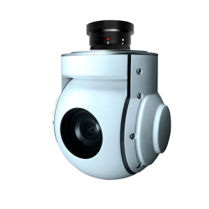
Gimbal & Sensors
 |
|
|
|
 |
|
|---|---|---|---|---|---|
|
Model |
24MP Mapper |
36MP Mapper |
42MP Mapper |
Mapper 61MP |
Oblique 120 |
|
Camera format: |
APS-C |
Full Frame |
Full Frame |
Full Frame |
5 x APS-C |
|
Sensor type: |
APS CMOS Exmor |
Exmor CMOS |
Exmor R® CMOS |
BSI CMOS |
CMOS |
|
Megapixel |
24.3 |
36.3 |
42 |
60.2 |
121.5 (24.3×5) |
|
Total Pixel |
6000 x 4000 |
7360×4912 |
7952 x 5304 |
9504×6336 |
5 x 6000 x 4000 |
|
Supported Lens |
25-35mm |
25-35-40-56mm |
25-35-40-56mm |
25-35-40-56mm |
25-35mm(included) |
|
Image Format |
JPEG, RAW,RAW+JPEG |
JPEG, RAW,RAW+JPEG |
JPEG, RAW,RAW+JPEG |
JPEG, RAW,RAW+JPEG |
JPEG, RAW,RAW+JPEG |
|
Hot Shoe signal: |
Yes |
Yes |
Yes |
Yes |
Yes |
|
RTK/PPK interface |
Yes |
Yes |
Yes |
Yes |
Yes |
|
Shutter Trigger: |
PWM |
PWM |
PWM |
PWM |
PWM |
|
Shutter Speed: |
30-1/4000sec |
30-1/8000sec |
30-1/8000sec |
30-1/8000sec |
30-1/4000sec |
|
Continuous shooting: |
3fps |
4fps |
2.5fps |
3fps |
1fps |
|
Storage |
SD Card-Max 512gb |
SD Card-Max 512gb |
SD Card-Max 512gb |
SD Card-Max 512gb |
SD Card-Max 512gb |
|
Setup |
Onboard/USB |
Onboard/USB |
Onboard/USB |
Onboard/USB |
Onboard/USB |
|
Data Reading |
USB3.0 |
USB3.0 |
USB3.0 |
USB3.0 |
USB3.0 |
|
Video Out |
Yes, Micro HDMI |
Yes, Micro HDMI |
Yes, Micro HDMI |
Yes, Micro HDMI |
No |
|
Power Supply |
9-28V@1.2A |
12-28V@1.2A |
12-28V@1.2A |
9-28V@1.2A |
9-28V@1.2A |
|
Operating Temperature |
-10+50°C |
-10+50°C |
-10+50°C |
-10+50°C |
-10+50°C |
|
Weight |
105(without lens) |
220(without lens) |
220(without lens) |
220(without lens) |
700g(with lens) |
|
Size |
73*62*36mm |
100*70*40mm |
100*70*40mm |
100*70*40mm |
160*160*120mm |
|
DJI PSDK |
Yes, SkyPort (optional) |
Yes, SkyPort (optional) |
Yes, SkyPort (optional) |
Yes, SkyPort (optional) |
Yes, SkyPort (optional) |
|
Pixhawk Ready |
Yes |
Yes |
Yes |
Yes |
Yes |
|
Standalone |
Yes |
Yes |
Yes |
Yes |
Yes |
|
|
 |
 |
 |
|
|---|---|---|---|
|
Model |
Flir Vue Pro R 336-640 |
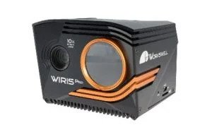
Workswell Wiris Pro |
Micasense Altum-PT |
|
Daylight Sensor |
N/A |
2.13MP-FullHD 1080p |
5.1 MP |
|
Optical Zoom |
N/A |
10x, F3.8,f~88.4mm |
|
|
Digital Zoom |
4x |
14x |
|
|
Thermal band |
|
7.5-13.5um |
7.5-13.5um |
|
Other Sensor |
|
|
3.2MP: Blue 475(32), |
|
Multiview |
|
✓ |
|
|
Max. range |
|
|
3000mt |
|
GPS Geotag |
Mavlink |
Mavlink-Direct |
Mavlink-Direct |
|
Quick-Mount |
✓ |
✓ |
✓ |
|
Video Out |
A/V |
HDMI-Ethernet |
WiFi |
|
Control |
PWM,Mavlink |
PWM,Mavlink,Ethernet,Can |
PWM,Sbus,UART,TCP |
|
Weight |
113g |
430g |
460g |
|
Dimension |
57*44*45 mm |
83*85*68 mm |
89*70*110 mm |
|
|
 |
 |
 |
 |
 |
|||
|---|---|---|---|---|---|---|---|
|
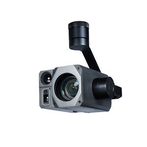
Model |
Zeta |
Zeta |
Zeta |
Gemini |
Sony |
||
|
EO Sensor |
25.9MP - 4k |
2.13MP - FullHD 1080p |
2.13MP - FullHD 1080p |
4.17MP - FullHD 1080p |
4.17MP - FullHD 1080p |
||
|
EO Optical Zoom |
20x, F=4.08~81.6mm |
30x, F=4.3~129mm |
30x, F=4.3~129mm |
30x, F=4.3~129mm |
30x, F=4.3~129mm |
||
|
EO Digital Zoom |
40x |
12x |
12x |
12x |
12x |
||
|
IR Sensor/ Pixel size |
|
640*480p |
|
640*512p - 12μm |
|
||
|
IR Lens |
|
25mm |
|
19mm |
|||
|
IR Fov |
|
H:63.7° |
|
H:22.9°, V:18.4° |
|||
|
IR digital zoom |
|
|
|
8x |
|
||
|
AI Target Detection |
|
|
|
✓ |
|
||
|
Object Tracking |
✓ |
✓ |
✓ |
✓ |
|
||
|
Laser range finder |
|
1500m |
|
1000m |
|
||
|
Target Geolocalization |
✓ |
✓ |
✓ |
✓ |
|
||
|
Starlight |
|
|
|
✓ |
|
||
|
KLV Meta Data (MPEG-TS) |
✓ |
✓ |
✓ |
✓ |
✓ |
||
|
Multiview |
|
✓ |
|
✓ |
|
||
|
Quick-Mount |
✓ |
✓ |
✓ |
✓ |
✓ |
||
|
IP Rating |
Ip43 |
Ip43 |
Ip43 |
Ip43 |
Ip43 |
||
|
Weight |
1395g |
587g |
815g |
1134g |
750g |
||
|
Dimension |
127.6*164.5*173.5mm |
135.5*135*120mm |
127.6*164.5*173.5mm |
173.5*128.7*204.6mm |
188*138.50*152mm |
||
|
|
 |
 |
 |
 |
|
 |
 |
||
|---|---|---|---|---|---|---|---|---|
|
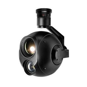
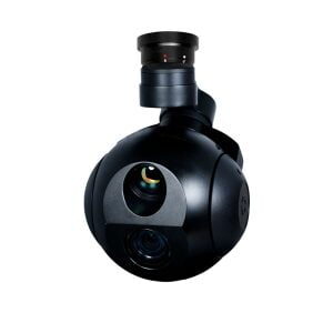
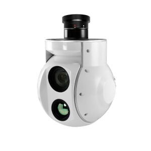
Model |
Gemini |
Gemini |
Gemini |
Gemini |
Gemini |
Gemini |
Zeta |
|
|
EO Sensor |
2.13MP - FullHD 1080p |
4.17MP - FullHD 1080p |
2.13MP - FullHD 1080p |
8.51MP - 4K |
4.17MP - FullHD 1080p |
2.13MP - FullHD 1080p |
2.13MP - FullHD 1080p |
|
|
EO Optical Zoom |
40x, f=4.25mm(wide end)~170mm(tele end) |
30x, f=6.5~162.5mm |
30x, F=4.3~129mm |
20x, F3.8,f~88.4mm |
30x, f=6.5~162.5mm |
30x, f=6.5~162.5mm |
30x, f=6.5~162.5mm |
|
|
EO Digital Zoom |
36x |
12x |
12x |
12x |
12x |
12x |
12x |
|
|
IR Sensor/ Pixel size |
640*512p - 12μm |
640*512p - 12μm |
640*480p - 17μm |
640*480p - 17μm |
1280*1024 - 12μm |
640*480p - 17μm |
|
|
|
IR Lens |
19mm |
19mm |
50mm |
25mm |
50mm |
25mm |
|
|
|
IR Fov |
H:22.9°, V:18.4° |
H:22.9°, V:18.4° |
H:12.4°, V:9.3° |
H:24.6°, V:18.5° |
H:17.5°, V:14° |
H:24.6°, V:18.5° |
|
|
|
IR digital zoom |
8x |
8x |
4x |
4x |
4x |
3x |
|
|
|
AI Target Detection |
✓ |
✓ |
|
|
|
|
|
|
|
Object Tracking |
✓ |
✓ |
✓ |
✓ |
✓ |
✓ |
✓ |
|
|
Laser range finder |
3000m |
1000m |
|
|
|
|
|
|
|
Target Geolocalization |
✓ |
✓ |
✓ |
✓ |
✓ |
✓ |
|
|
|
Starlight |
|
✓ |
|
|
✓ |
|
|
|
|
KLV Meta Data (MPEG-TS) |
✓ |
✓ |
✓ |
✓ |
✓ |
✓ |
✓ |
|
|
Multiview |
✓ |
✓ |
✓ |
✓ |
✓ |
|
||
|
Quick-Mount |
✓ |
✓ |
✓ |
✓ |
✓ |
✓ |
✓ |
|
|
IP Rating |
Ip43 |
Ip43 |
Ip43 |
Ip43 |
Ip43 |
Ip43 |
Ip43 |
|
|
Weight |
1198g |
1134g |
1395g |
1060g |
1732g |
1151g |
732g |
|
|
Dimension |
130*134.7*219mm |
173.5*128.7*204.6mm |
127.6*164.5*173.5mm |
118.7*132.3*200.8mm |
162.8*146*245.8mm |
127*122*177.1mm |
115.8*103.5*175.4mm |
|
|
|
 |
 |
 |
 |
|
|---|---|---|---|---|
|
Model |
Micasense |
Micasense |
Micasense |
Micasense |
|
Daylight Sensor |
3.6 MP |
3.6 MP |
5.1 MP |
5.1 MP |
|
Thermal Sensor |
|
|
|
320*256 - 30hz |
|
Thermal band |
|
|
|
7.5-13.5um |
|
Multispectral Sensor |
1.2mp: Coastal Blue 444(28)*, Blue 475(32), Green |
1.2mp: Coastal Blue 444(28)*, Blue 475(32), Green |
1.6mp: Blue 475(32), Green 560(27), Red 668(14), Red Edge 717(12), NIR 842(57) |
1.6mp: Blue 475(32), Green 560(27), Red 668(14), Red Edge 717(12), NIR 842(57) |
|
GPS Geotag |
Mavlink-Direct |
Mavlink-Direct |
Mavlink-Direct |
Mavlink-Direct |
|
Quick-Mount |
✓ |
✓ |
✓ |
✓ |
|
Video Out |
WiFi |
WiFi |
WiFi |
WiFi |
|
Control |
PWM,Sbus,UART,TCP |
PWM,Sbus,UART,TCP |
PWM,Sbus,UART,TCP |
PWM,Sbus,UART,TCP |
|
Weight |
231g |
508g |
350g |
460g |
|
Dimension |
87*123*76 mm |
87*123*76 mm |
89*70*67 mm |
89*70*110 mm |
|
|