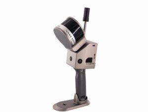
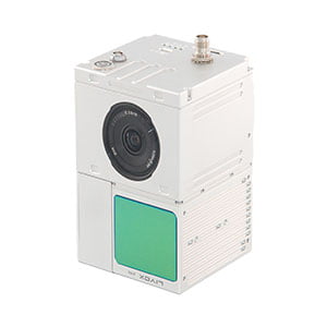
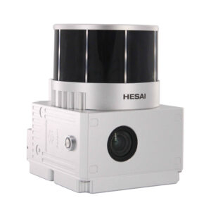
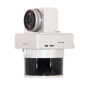
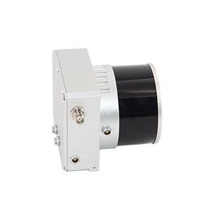
3D LIDAR for Drones

Lidar For Drones, 3D Lidar For Drones

Model

Gs100G
Gs100C+
Gs100V
Gs130X
Gs260X

Weight

1.8kg(with battery)

1036g

1.4kg

1.26kg

1.9kg

Measuring accuracy

5cm@100m

≤ 10cm @110m AGL

Less than 0.1m @100m

≤ 10cm@150m AGL

10cm/5cm (@150m)

Working temperature

-20℃~+55℃

-20℃~+55℃

-20℃~+55℃

-20℃~+55℃

-20℃~+65℃

Power range

12V-18V

12 V- 16 V

12 V- 24 V

12 V- 16 V

12 V- 24 V

Consumption

25W

Average 20 W

Average 20 W

Average 15 W

20 W

Carrying Platform

Hand-held, Multi-rotor and Vehicle

Multi Rotors/VTOL

Drone and Vehicle

Multi Rotors/VTOL

Multi Rotors/VTOL

Storage

Build-in Flash memory 64GB, Support microSD 256GB

4GB, Max support 128GB TF card

4GB, Max support 128GB TF card

4GB, Max support 128GB TF card

4GB, Max support 128GB TF card

Detection Range

80m@10%

190m@10%

80m@10%

200m@20%

200m@20%

Laser class

905nm Class1

905nm Class1

Laser line number

16 Channel

64-beam

16-Channel

32 Channel

32 Channel

Max. range

120m

450m

120m

200m

200m

Range accuracy

±1.5 cm

2 cm (1σ @ 20m)

±1cm

1 cm

Scanning frequency

None

None

10HZ, 20HZ

None

None

Laser pulse frequency

None

None

None

None

None

date

Dual echo 640,000 Points/Sec.

Triple echo 720,000 Points/Sec

Double echo 640,000 Points/Sec

Double echo 1,280,000 Points/Sec.

Double echo 1,280,000 Points/Sec.

FOV

H:360°, V:270°

70°x 77.2°

360°

360°

360°

Laser sensor

HESAI XT16

Livox Avia

HESAI XT16

HESAI Pandar XT (Customize)

HESAI Pandar 40P

POS system

gSpin 210

AGS 302

AGS 302

AGS 303

AGS 303

Update frequency

200HZ

200HZ

Heading accuracy

0.040°

0.040°

0.040°

0.017°

0.017°

Pitch accuracy

0.015°

0.015°

0.015°

0.005°

0.005°

Rolling accuracy

0.015°

0.015°

0.015°

0.005°

0.005°

Position accuracy

Horizonal 0.02m Elevation 0.03m

≤ 5 cm

≤0.05m

GNSS signal type

GPS L1/L2/L5, GLONASS L1/L2, BDS B1C/B1/B2/B2a/B2b/B3, GALILEO E1/E5b/E5a

GPS L1/L2/L5,GLONASS L1/L2 BDS B1/B2/B3,GAL E1/E5a/E5b

GPSL1/L2/L5 GLONASSL1/L2 BDS B1/B2/B3 GAL E1/E5a/5b

Trajectory Software

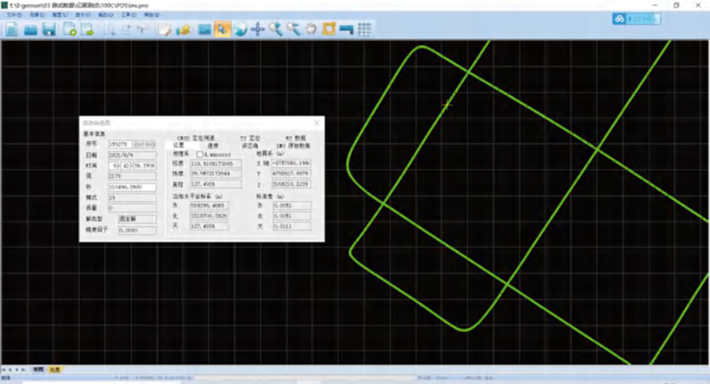
Point cloud software

Sony A6000 (Industrial)

Option

Standard

Standard

Option

Option


Agricultural Remote Sensor

Foresty Survey

Smart City Corporation

Powerline Patrol

Topographic survey

Rail Maintanance

Mine Survey

River Beach Survey

POS SYSTEM

The Gspin aviation application product is an integrated GNSS / INS system designed and developed for geo-referenced aircraft direct
sensor data. By integrating high-precision differential GNSS positioning technology with INS navigation technology, it makes the solution of position and attitude information of spatial objects more accurate and efficient. Gspin can be integrated with aerial cameras, a variety of image sensors and lidar technology.

Lidar For Drones, 3D Lidar For Drones

Gspin is based on the direct geographic reference method. It is a revolutionary technology in aeronautical investigation
And the remote sensing industry. Direct geographic reference is to directly measure position and sensor data
(also known as external orientation elements) without further information about the ground control point.
These parameters make it possible to directly resolve data collected by airborne sensors
With reference to the earth or local coordinate system.

The Gspin aviation application product is an integrated GNSS / INS system designed and developed for direct georeferenced airborne sensor data.

Integrating high-precision GNSS differential positioning technology with INS navigation technology,
makes the solution of position and attitude information of spatial objects more accurate and efficient.
Gspin can be integrated with aerial cameras, a variety of image sensors and lidar technology. Gspin is based on the direct geographic reference method.

This is a revolutionary technology in aviation survey and remote sensing.
Direct geographic reference is to directly measure the position and sensor data (also known as external orientation elements) without any additional information about the ground control point. These parameters allow data collected by airborne sensors to be resolved directly with reference to the earth or local coordinate system.

Main feature

  • Provide a real-time or high-precision post solution for the motion vector
  • Can replace aerial triangulation and full ground control point measurement
  • The existing DEM can be used for pattern mapping of a single stereo image pair and correction of a single chip
  • Greatly improve the production efficiency and accuracy of traditional aerial mapping applications
  • Easy integration with digital cameras, lidar and digital scanners
  • It is particularly suitable for sparsely populated areas without existing control points or applications that require rapid response

Talk to one of our Experts

DroneBase provides you with an Expert Advisor
Able to recommend the most appropriate product for your needs
And answer all your questions.

Call us NOW!
+39.0541.1790411
Request information

Please enter your details below, our consultant will
will contact back as soon as possible and provide you with all the details!


    Talk to an Expert

    Thank you for your interest in our solutions

    Fill out the Form opposite and you will be contacted
    by one of our Expert Advisors who will provide you with
    The Best Solution for Your Need!

    Thank you for your confidence.

    Team DroneBase

      Download Now

      Thank you for your interest in our applications.

      Fill out the Form next to it to receive:

      • Dataset
      • Abstracts
      • Report
      • Full Datasheet

      Request a consultation with one of our Experts to Point you to the Best Solution for Your
      Necessity!

      Thank you for your confidence.

      Team DroneBase

        Download Now

        Thank you for your interest in our applications.

        Fill out the Form next to it to receive:

        • Dataset
        • Abstracts
        • Report
        • Full Datasheet

        Request a consultation with one of our Experts to Point you to the Best Solution for Your
        Necessity!

        Thank you for your confidence.

        Team DroneBase

          Talk to an Expert

          Thank you for your interest in our applications

          Fill out the Form opposite and you will be contacted by one of our Expert Consultants who will provide you with the Best Solution for YOUR NEEDS!

          Thank you for your confidence.

          Team DroneBase

            Talk to an Expert

            Thank you for your interest in our Video Surveillance solutions

            Fill out the Form opposite and you will be contacted
            by one of our Expert Advisors who will provide you with
            The Best Solution for Your Need!

            Thank you for your confidence.

            Team DroneBase

              Download Now

              Thank you for your interest in our applications.

              Fill out the Form next to it to receive:

              • Dataset
              • Abstracts
              • Report
              • Full Datasheet

              Request a consultation with one of our Experts to Point you to the Best Solution for Your Need!

              Thank you for your confidence.

              Team DroneBase

                Download Now

                Thank you for your interest in our applications.

                Fill out the Form next to it to receive:

                • Dataset
                • Abstracts
                • Report
                • Full Datasheet

                Request a consultation with one of our Experts to Point you to the Best Solution for Your
                Necessity!

                Thank you for your confidence.

                Team DroneBase