

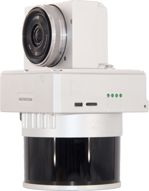
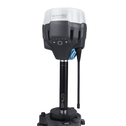
GS130X
GS130X
The professional 3D Lidar for drone
most compact and efficient on the market.
Why choose the GS130X 3D Lidar?
GS-130X combines a compact and lightweight design with detection range
and incredible efficiency combined with a price never seen before thanks to LIVOX technology.
The GC130X includes a Livox Lidar module, a high-precision IMU and an integrated centimeter GPS system. GS130X is a complete, stand-alone solution compatible with any drone on the market that can capture complex structures by providing reconstructed models particularly
1280k
point/sec
dual-echo
point rate
120
mt
max
range
1.0
cm
range
precision
1000
ha/hour
max area
scan
360°
fov
circular
view
200
hz
imu
sensor
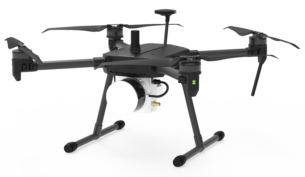
The most compact and high-performance drone lidar ever
Its design allows the device to be installed on any drone or ground vehicle.
Quick and easy to use, it is ready to scan within 2 minutes of being turned on.
The technical specifications of the GS100 3D Lidar make it the ideal partner for the
More demanding topographers looking for an accurate and reliable instrument.
GS100 is suitable for any application, depending on the vehicle on which it is mounted:
From a classical topographic survey to agro-forestry surveys.
Main features
– 640,000 points/second Single Echo
– 1,280,000 points/second Double Echo
– Integrated 200hz IMU by GSN
– Fov 360° circular
– Maximum measuring range 120mt*
– L1-L2 GNSS integrated (2-5cm accuracy)
– 905nm Laser Class1 (IEC 60825-1:2014)
– Integrated control unit to synchronize sensor data
– RGB camera Ready(Sony Alpha 24-61mp)
– Compact and lightweight (1.26kg)
– Sturdy aluminum bodyCompatible with Multirotors, Fixed Wings, Vtol and Ground Vehicles
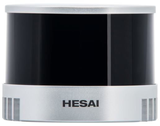
HESAI 3D Lidar Module
– Lidar framing with up to 100% effective point cloud results
– Detection range:
– 120 m (90% reflection)
– 80 m (10% reflection)
– Effective Points: 640,000 points/s
– Supports 2 returns
– Type of Scan: repetitive, non-repetitive
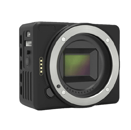
Industrial camera
– Brand : Sony
– Model : Sony A6000 – A7RII
– Sensor: APS-C – Full Frame
– Resolution : 24 – 42mp
– Lens : Low distortion 35mm
– Mechanical shutter
– Memory : Integrated 64gb
– Trigger : by time/distance
Unprecedented accuracy
It renders centimeter-accurate reconstructions thanks to the high-precision IMU, a vision sensor for positioning accuracy, and the incorporation of GNSS data.
Fast and Easy
GS100V is a Solid and Reliable 3D Lidar for Drones supported by Smart software,
simple and intuitive that allows you to close the entire process up to the generation of the dense point cloud
PLANNING
Simplified scan planning with Professional Software and Dedicated Tools.
Select Area, Altitude and Speed, the software takes care of the rest.
FLY
Fully automatic flight missions from takeoff to landing. Select Area, Altitude and Speed, the software takes care of the rest.
PROCESS
Complete processing of GPS/IMU data using the supplied Shuttle software. Point cloud processing using gAirHawk processing software
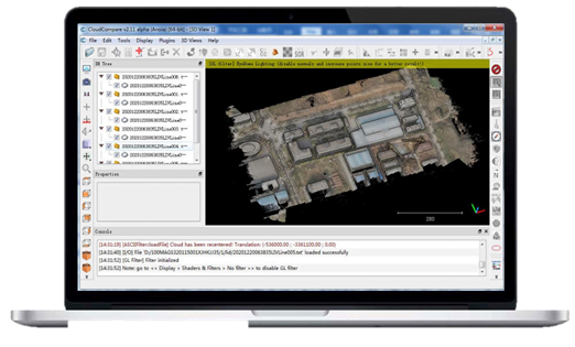
VIEW
LAS-format point cloud creation that can be used with any GIS or CAD software environment Fast and accurate coloring of the point cloud with orthomosaics produced by the RGB Camera
Color the cloud of dots
All our 3D Lidar systems thanks to the plug&play “EXT” interface
support External or Integrated Cameras and automatically manage their photo acquisition and centimeter georeferencing using the Lidar GNSS system.
The ability to connect one or more cameras to the lidar allows
The RGB coloring of the point cloud obtained with the same.
The point cloud coloring process starts with the same post-processing software that comes with the lidar
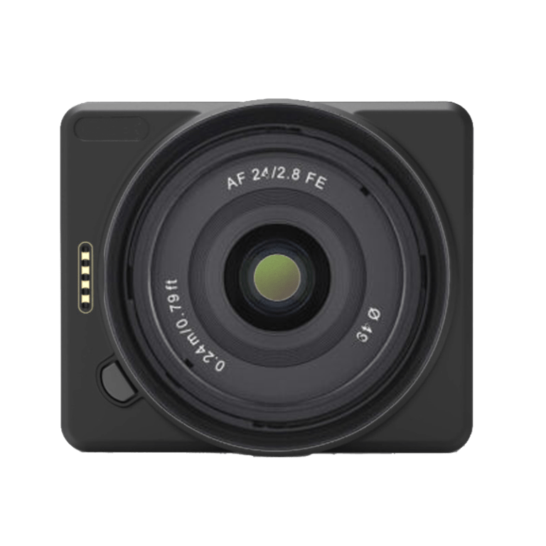
Technical details Available cameras
– Model: Sony A6000/A7R2 (industrial)
– Sensor resolution: 24/42mp
– Lens: low distortion 35mm
– Memory: 128gb max
– Trigger: time or distance
Centimeter Accuracy
WITHOUT GCPs
Dramatically reduce scanning time,
Decrease the volume of data to be processed!
Safely tackle 3D Lidar mapping work in hazardous or inaccessible locations without having to place GCPs
Dramatically reduce scanning time,
Decrease the volume of data to be processed!
Safely tackle 3D Lidar mapping work in hazardous or inaccessible locations without having to place GCPs

PPK Technology
No Target on the ground due to Direct Centimeter Georeferencing with PPK* (Post Processing Kinematic) Technology. Centimeter georeferencing of the point cloud and RGB photos is handled in post processing by the supplied Shuttle software.
– Automatic correction of GPS data
– Fast management and export of Rinex logs
– Up to 2cm RMS accuracy.
* Compatible with any GNSS Base, VRS or CORS.
** Detected in PPK
Easy and safe acquisition
Designed by surveyors for surveyors for complex and long-duration flight operations.
The gAirhawk post-processing software included with GS100c+
allows the operator to have in a few moments after the flight immediate information necessary to ensure proper acquisition even in difficult working conditions.
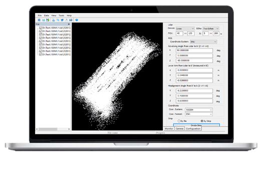
Fast and Accurate Post Processing
In just a few steps, the included gAirhawk software merges the data
IMU and GNSS for point cloud and RGC (if camera present) calculations and performs POS data calculations so that 3D Accuracy models can be easily generated providing a three-dimensional representation of the newly acquired “LAS “point cloud.
Complete Solutions for Professionals
DroneBase offers you complete and reliable Drone + Lidar 3D solutions,
Designed by professionals for professionals.
Our professional drones combined with 3D Lidar become unstoppable geomatics machines in the fields of construction, land development, engineering, surveying and research.
Caratteristiche tecniche |
Item Name |
System Parameters |
|---|---|---|
|
GS-130X Parameters |
Weight |
1.26 kg (without camera) |
|
Lidar Unit |
Measuring Range |
0.3m-120m@10% Reflectivity |
|
POS Unit |
Update frequency |
200HZ |
|
Pre-processing software |
POS software |
Output information: position, speed, attitude |
|
Room (option) |
Camera Model |
Sony RX1/a 6000 |
Hardware
– 1 x gAirHawk GS-130X Lidar
– 1 x GNSS Antenna L1-L2
– 1 x Micro SDCard 128gb
– 1 x USB flash drives 8gb
– 1 x Software Usage Manual
– 1 x Video Tutorial
Software:
– 1 x gAirHawk, GNSS post-processing and inertial data
– 1 x Shuttle for cloud georeferencing
Services:
– 1 x 1-year warranty
– 1 x Online technical support
Talk to one of our Experts
DroneBase provides you with an Expert Advisor
Able to recommend the most appropriate product for your needs
And answer all your questions.
Call us NOW!
+39.0541.1790411
Request information
Please enter your details below, our consultant will
will contact back as soon as possible and provide you with all the details!
