


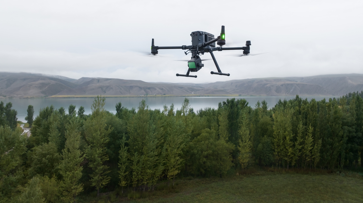
Supported by its powerful hardware, L2 can enable accurate scanning of complex subjects within an extended range and faster point cloud acquisition. During operations, users can preview, play back, and process point cloud models on site with DJI Terra-generated asset quality reports, providing a simple and comprehensive solution to improve overall efficiency. This enables users to obtain high-precision point cloud results with unique post-processing.
By combining GNSS and a high-precision IMU developed in-house, this solution
achieves a vertical accuracy of 4 cm and a horizontal accuracy of 5 cm.
It is ready to operate as soon as it is turned on and can collect both geospatial data
than RGB from an area of 2.5 square kilometers in a single flight.
In combination with Matrice 350 RTK and DJI Terra, L2 offers an easy-to-use turnkey solution by lowering the operational threshold.
L2 can detect from 250 meters with 10% reflectivity and 100 klx, and up to 450 meters with 50% reflectivity and 0 klx. The operational altitude
typical now extends up to 120 meters, greatly improving safety and operational efficiency.
With a reduced spot size of 4×12 cm at 100 m, only one-fifth that of L1, L2 not only detects smaller objects with more detail, but can also
penetrate the denser vegetation, generating more accurate digital elevation models (DEMs).
In densely vegetated areas, L2 can capture more ground points under the foliage.
In both single and multiple return modes, L2 can achieve a maximum point cloud emission rate of 240,000 points per second, enabling
The acquisition of multiple point cloud data in a given time interval.
L2 supports two scanning modes, offering flexibility to users according to their business needs. In the repetitive scanning mode, L2’s LiDAR can achieve more uniform and precise point clouds while meeting high-precision mapping requirements. In non-repetitive scanning mode, it offers deeper penetration for more structural information, making it suitable for power line inspection, forestry survey and other scenarios.
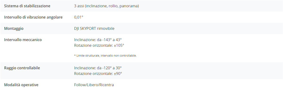
Frame-based design ensures effective point cloud data rates of up to 100%. Together with a three-axis gimbal, it offers
Increased possibilities for scenario detection.
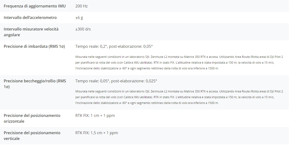
The self-developed high-precision IMU system, combined with the drone’s RTK positioning system for data fusion during post-processing, provides L2 with access to highly accurate absolute position, velocity and attitude information. In addition, the increased environmental adaptability of the IMU system improves the operational reliability and accuracy of L2.
Real time: 0.2°, post-processing: 0.05°
Real-time 0.05°, post-processing 0.025°
The performance of the IMU system has been greatly improved, and it is ready for use the moment it is turned on. In addition, the companion drone is ready to start activities immediately once the RTK is in FIX state, providing an optimized field experience.
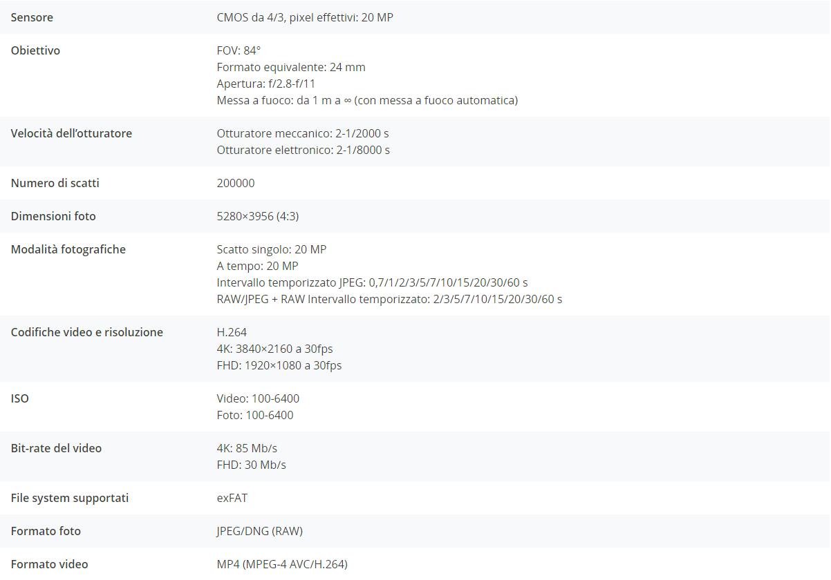
The pixel size has been expanded to 3.3 μm, and the effective pixels now reach 20 MP, resulting in a significant improvement in the overall image and more enriched true-color point cloud details. The minimum interval between photos has been reduced to 0.7 seconds. The mapping camera can count up to 200,000 shutters, further reducing operating costs. When point cloud collection is not necessary, the RGB camera can still take photos and record video or collect images for visible light mapping.
Supports waypoint, area, and linear path types to handle surveying tasks in a variety of environments.
During operation, DJI Pilot 2 supports three display modes: RGB, point cloud and side-by-side point cloud/RGB display, presenting operational results in an intuitive way. Activating the RNG (laser rangefinder) provides access to distance information between the LiDAR module and the object in the center of the FOV, improving flight safety. It also supports four real-time point cloud coloring modes: Reflectivity, Height, Distance and RGB.
After the operation, the 3D model of the point cloud can be viewed directly in the album. It is also possible to merge 3D point cloud models from multiple flights, enabling on-site decision making regarding operational quality.
After point cloud data is collected, the DJI Pilot 2 app will automatically generate an activity quality report 8 so that operators can check operational results in real time and on the spot, making field work more responsive and worry-free.
Supports waypoint, area, and linear path types to handle surveying tasks in a variety of environments.
Get efficient and reliable one-stop post-processing when importing point cloud data into DJI Terra. Generates a 3D point cloud model in standard format with one click after point cloud trajectory calculation and accuracy optimization. After land point classification, using the land point type, a DEM can be generated. The quality of the point cloud can be analyzed with the Check and Verify Accuracy function.
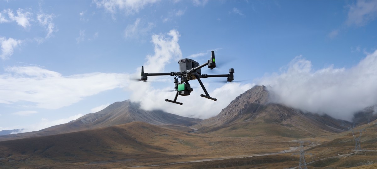
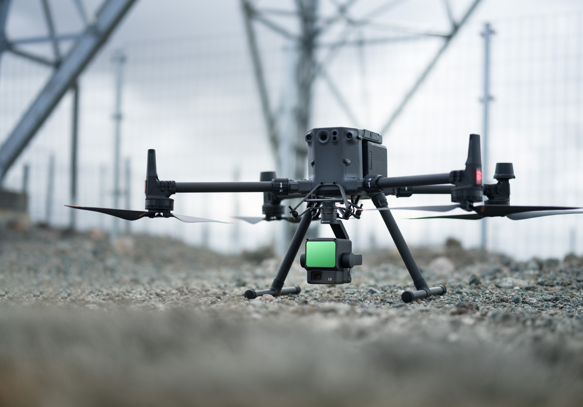
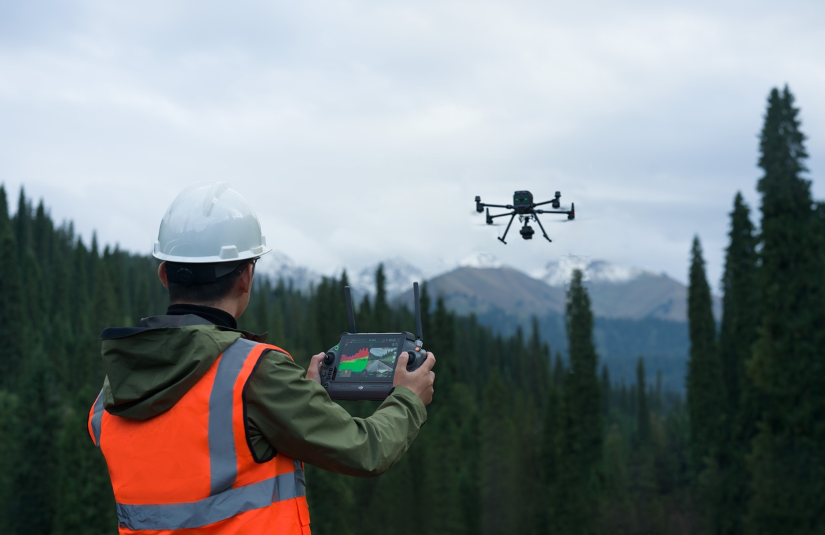
In coordination with DJI Enterprise and DJI Terra flight platforms, Zenmuse L2 can be applied to land surveying and mapping, electricity, forestry and infrastructure management, as well as other scenarios.
– Upon activation of the Zenmuse L2, using the same DJI account to access the DJI Terra program (previously installed) will automatically activate the Point Cloud processing feature permanently
– At the same time, on the same DJI account used to activate the Zenmuse L2, a trial period for full DJI Terra features, including reconstruction from RGB photos, will be activated. This trial period will last for 3 months from the activation of the Zenmuse L2 sensor.
– After 3 months, the features will deactivate, except for point cloud processing, which will remain basic
– To process data from the Zenmuse L2, you will need to use DJI Terra V3.9 or later


Reviews
There are no reviews yet.