€9,897.86 IVA Inclusa
Includes:
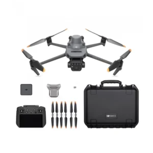
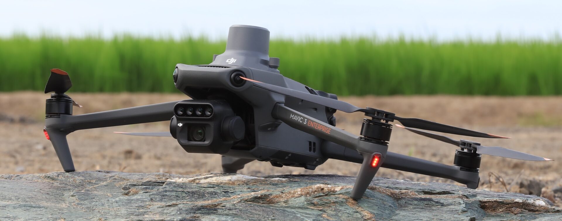
1 x DJI Mavic 3 Multispectral – Care 1 Year
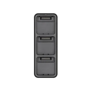
1 x DJI Mavic 3 Enterprise Battery Kit
1 x D-RTK 2 High Precision GNSS Mobile Station
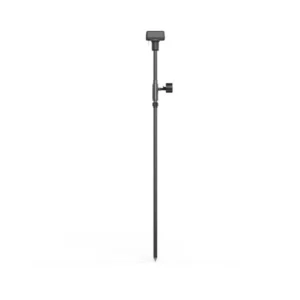
1 x DJI D-RTK 2 Base Tripod Station
1 x DJI Terra Pro Overseas 1 year (1 device)
1 x Silver 2-hour remote support (5 tickets)- Telehealth
1 x Complete enac manuals + d-flight portal registration
1 x Dronist’s Fee Schedule 2023
1 x Drones: how to fly in the red zone legally.
1 x Guide to mandatory drone insurance
1 x Express shipping


The combos in the Agriculture range include everything professionals need
(Drones, Sensors, Software) for Drone Photogrammetry, Mapping, Architectural Survey and GIS
Aerial drone surveying and photogrammetry is not only about drone.
DroneBase provides integrated systems, complete with Calibrated Sensors and precision GPS,
Specific flight planning software and APPs,
accurate workflows, post processing software, professional training and support.
1 x DJI Mavic 3 Multispectral – Care 1 Year
1 x DJI Mavic 3 Enterprise Battery Kit
1 x D-RTK 2 High Precision GNSS Mobile Station
1 x DJI D-RTK 2 Base Tripod Station
1 x DJI Terra Pro Overseas 1 year (1 device)
1 x Silver 2-hour remote support (5 tickets)- Telehealth
1 x Complete enac manuals + d-flight portal registration
1 x Dronist’s Fee Schedule 2023
1 x Drones: how to fly in the red zone legally.
1 x Guide to mandatory drone insurance
1 x Express shipping
L’obiettivo di industria 4.0 è quello di incentivare le aziende italiane che investono in beni strumentali per migliorare, attraverso la digitalizzazione, i propri processi produttivi.
Questo si traduce in vantaggi Fiscali da una parte e Produttivi dall’altra.
DroneBase ti mette a disposizione un Consulente Esperto
in grado di consigliarti il prodotto più adeguato alle tue necessità
e rispondere a tutte le tue domande.
Inserisci i tuoi dati quì sotto, il nostro consulente ti
ricontatterà al più presto e ti fornirà tutti i dettagli!

© 2023 all rights reserved
WhatsApp us
Grazie per il tuo interesse nelle nostre soluzioni
Compila il Form qui affianco e sarai contattato
da un nostro Consulente Esperto che ti fornirà
la Migliore soluzione per la Tue Necessità!
Grazie della tua fiducia.
Team DroneBase
Thank you for your interest in our solutions
Fill out the Form opposite and you will be contacted
by one of our Expert Advisors who will provide you with
The Best Solution for Your Need!
Thank you for your confidence.
Team DroneBase
Thank you for your interest in our applications.
Fill out the Form next to it to receive:
Request a consultation with one of our Experts to Point you to the Best Solution for Your
Necessity!
Thank you for your confidence.
Team DroneBase
Thank you for your interest in our applications.
Fill out the Form next to it to receive:
Request a consultation with one of our Experts to Point you to the Best Solution for Your
Necessity!
Thank you for your confidence.
Team DroneBase
Thank you for your interest in our applications
Fill out the Form opposite and you will be contacted by one of our Expert Consultants who will provide you with the Best Solution for YOUR NEEDS!
Thank you for your confidence.
Team DroneBase
Thank you for your interest in our Video Surveillance solutions
Fill out the Form opposite and you will be contacted
by one of our Expert Advisors who will provide you with
The Best Solution for Your Need!
Thank you for your confidence.
Team DroneBase
Thank you for your interest in our applications.
Fill out the Form next to it to receive:
Request a consultation with one of our Experts to Point you to the Best Solution for Your Need!
Thank you for your confidence.
Team DroneBase
Thank you for your interest in our applications.
Fill out the Form next to it to receive:
Request a consultation with one of our Experts to Point you to the Best Solution for Your
Necessity!
Thank you for your confidence.
Team DroneBase